
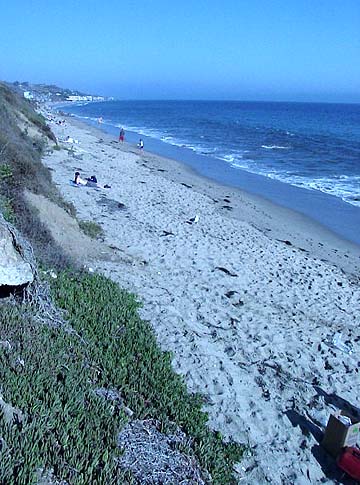
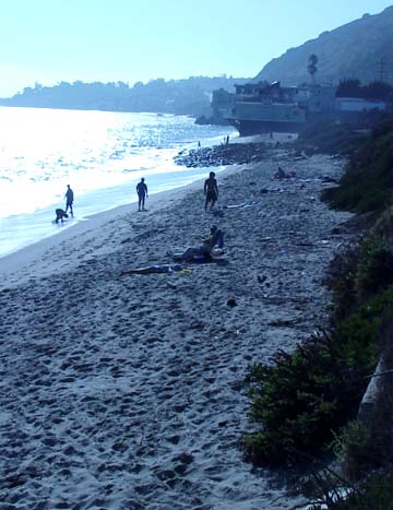
Founders Park, Rancho Palos Verdes, CA

Sitting on the south side of the Trump National Golf Course Clubhouse, is Founders Park with it’s 5.5 tranquil acres with breath taking ocean views, picnic tables, a gazebo, coastal access and adjacent walking trails. In 2006, it was formally named in honor of the City’s founders who led the effort to incorporate the City of Rancho Palos Verdes more than 30 years ago.
This is a well-visited park because of its fabulous location and unbelievable ocean views. This is one of the few parks which allow ceremonies to be held in its open area. Planned events are limited to one event per day (3 hours max) between the hours of 9:00 a.m. to 3:00 p.m. The spectacular view of the Pacific Ocean and Catalina Island make for a nice back drop along with the custom built gazebo. There are also optional packages such as chair rentals, and ceremony coordinators that can be arranged with the City’s Recreation and Parks staff. There are nearby restrooms and public parking is also available to visitors.
For more information about rental rates and availability, contact Marcella at (310) 544-5280. Founders Park is located at One Ocean Trails Drive, Rancho Palos Verdes 90275.


Abalone Cove Shoreline Park, Rancho Palos Verdes, CA

Park hours:
Open
Mon. - Fri. 12:00 noon - 4:00p.m.
Sat. & Sun. 9:00a.m. - 4:00p.m.
Memorial Day-Labor Day
9 am-4pm
Closed
January 1, Thanksgiving Day, December 24, December 25
Parking lot fees:
$5 per car
$15 per bus
No charge for seniors Labor Day through Memorial Day


Mark Visser Rides JAWS at Night!
There are some adventurous, risk-taking people in the world. Mark Visser is one of them. This is one gnarly ride. 30- to 40-foot waves. At night. Ca-razy!
In the LA Times article, he said, "It wasn't until I saw the pictures I realized how big it was. I had to go off feeling. It was the scariest but most exciting thing I have ever done."


Torrance State Beach, Torrance California

Along Paseo de la Playa
Torrance, CA 90277
Torrance Beach Surf Cam
Looking for a beach in the South Bay where you can get away from it all? This is it. This is where the bike path ends and begins, and the South Bay meets Palos Verdes Estates. The general feeling of this beach is seclusion. Hills of flowers and cliffs protect the beach from the street, as it curves around into the cliffs of Palos Verdes Estates.
A popular longboarding beach, it is best on a North/ Northwest swell. Other activities include swings and volleyball. The restrooms and showers are all very clean. Torrance County Beach is often less crowded than neighboring Redondo Beach, which makes it an ideal spot for a peaceful afternoon of tanning. For a more active beach day, grab a bike or some skates and naviagte the 22 miles of winding, beachside concrete known as the South Bay Bicycle Trail, which runs from Torrance to Will Rogers State Beach.


Latigo Beach, Malibu California

Latigo Beach, Malibu California


Latigo Shore Drive and PCH
Malibu, CA 90265


Corral Canyon Beach, Malibu California
Corral Canyon County Beach is a nice stretch of sandy coastline that is great for summer swimming, bodysurfing and boogie boarding. When the surf is flat bring your snorkeling gear and swim across the living reef. You will come face to face with all sorts of underwater sea life when exploring the living reef. Schooling dolphins are plentiful so keep your eyes and ears open (you can hear them underwater). There is a restauraunt that offers fresh seafood. It is very pleasant to enjoy your dinner while watching the sun sinking into the Pacific Ocean.
Pacific Coast Highway and Corral Canyon
Malibu, CA 90265

Topanga Beach, Malibu California

Topanga State Beach is located off the Pacific Coast Highway. This is a somewhat secluded beach setting and offers a bit of a point break for some great kayak surfing. Other activities include swimming, surfing, and fishing. There is a picnic area and catamaran storage. A general store is across the street. A short decent down easy stairs takes you to the beach. The beach has bathrooms and a freshwater shower rinse area, lifeguard building, and police sub-station. There is a sandy beach for bathers. The main surfing area has round smooth rocks at the waterline but further off the main breakers is great kayak surfing with sandy beach landings.
Directions: From the 405 S, exit Sunset Blvd. and travel west to Pacific Coast Highway, turn N on PCH approximately two miles. Topanga State Beach is on the west side of the road. Fee Parking. Here is a great article on this area, take a read here.


Topanga, California (CNN) -- If you have Neil Young's "After the Gold Rush" on your computer, you should play it while you read this. If you have it on vinyl, even better.
Young, one of the great singer-songwriters, recorded and wrote much of this album in Topanga Canyon, an eye blink of a community just west of Los Angeles in the Santa Monica Mountains read more
Hermosa Beach, California


A sun-drenched beach village of just 1.3 square miles, Hermosa Beach sits at the edge of the Pacific, just 5 miles south of Los Angeles. The town is the very essence of the Southern California lifestyle, and the mild weather patterns make it an ideal vacation spot all-year round. Temperatures range from highs of 77 degrees in the summer to a balmy 67 degrees in winter, with the nighttime temperatures rarely going below 50 degrees. The spectacular coastline, wide sandy beach, rich history and specialty shops make this community a favorite with Californians. Hermosa Beach is much more than sand and surf. This lively beach village offers up live music with choices from rock to blues to jazz. In the summer months, the city features Sunset Concerts on the Beach for the whole family to enjoy. Check out the Hermosa Beach Live Web Cam here.
While you are here make sure you enjoy the great food at Good Stuff Reastaurant you will be glad you did.
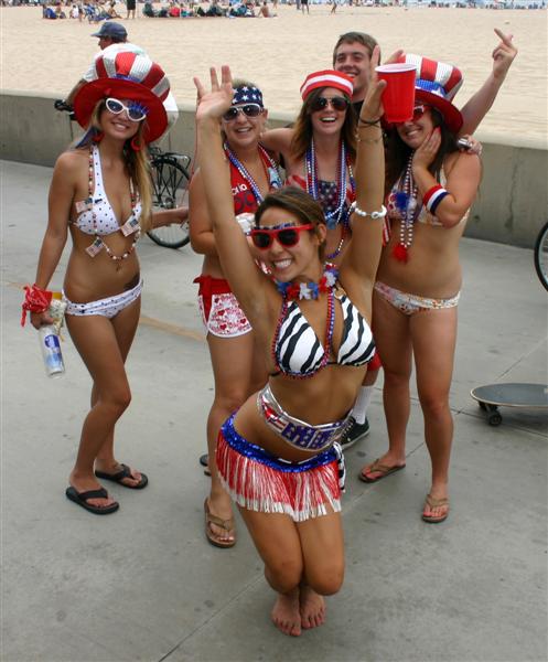 |
| July 4th, Hermosa Beach California |


Leo Carrillo State Park, Malibu California
Leo Carrillo State Park has 1.5 miles of beach for swimming, surfing, windsurfing, surf fishing and beachcombing. The beach also has tide pools, coastal caves and reefs for exploring. Giant sycamores shade the main campgrounds. The park also features back-country hiking.
Nature walks and campfire programs are offered and a small Visitor Center has interpretive displays. During the summer, children's programs are available.

The park was named after Leo Carrillo (1880-1961), actor, preservationist and conservationist. Leo Carrillo served on the California Beach and Parks commission for eighteen years, and was instrumental in the state's acquisition of the Hearst property at San Simeon. He was related by blood and marriage to a long line of distinguished original Californians. Leo's greatest fame came from his portrayal of Pancho, the sidekick to Duncan Renaldo's Cisco Kid, an early 1950's TV series.

Leo Carrillo State Park is located at:
35000 W. Pacific Coast Highway
Malibu, CA 90265
(818) 880-0363

![]()


 |
| Pacific Coast Hwy at Mulholland Hwy |

The park was named after Leo Carrillo (1880-1961), actor, preservationist and conservationist. Leo Carrillo served on the California Beach and Parks commission for eighteen years, and was instrumental in the state's acquisition of the Hearst property at San Simeon. He was related by blood and marriage to a long line of distinguished original Californians. Leo's greatest fame came from his portrayal of Pancho, the sidekick to Duncan Renaldo's Cisco Kid, an early 1950's TV series.
- Features of Leo Carrillo State Park include some 1.5 miles of beach, tide pools & coastal caves; the park also offers camping facilities & back-country hiking
- There is a small Visitor Center which has interpretive displays (it was closed during our visit); during the summer, children's programs are available
- Nature walks and campfire programs are also offered
- Portable toilets in the parking area; flush toilets at the beach
- Outdoor showers can be accessed in the camping area
- Parking is $12; free with a California State Parks Pass
- Check water quality before you go & plan your visit accordingly
35000 W. Pacific Coast Highway
Malibu, CA 90265
(818) 880-0363


Subscribe to:
Posts (Atom)